

Please login in order to download photos in full size
If you are not registered, please register for free: www.Free-Photos.biz/register
Please note to download premium images you also need to join as a free member..
You can also save the photos without the registration - but only in small and average sizes, and some of them will have the site's watermark. Please simply click your right mouse button and save the image.
Please login in order to like photos
If you are not registered, please register for free:
Sorry, non-members can download up to 1100 full-size photos per month.
It looks like you have used up your limit.
Free members can download an unlimited number of full-size photos - including the premium free photos.
Join as a member today for FREE! - and download the images without limitations:
www.Free-Photos.biz/membership.php
You can also save the images without the membership - but only in small and average sizes, and some of them may have the site's watermark. Please simply click your right mouse button and save the image.
|
This is a premium free photo
This photo was viewed 5 times and was downloaded in full size 2 times.
This photo was liked 0 times


If you are a member, please login in order to see the source link of the above image.
Summary
| Description |
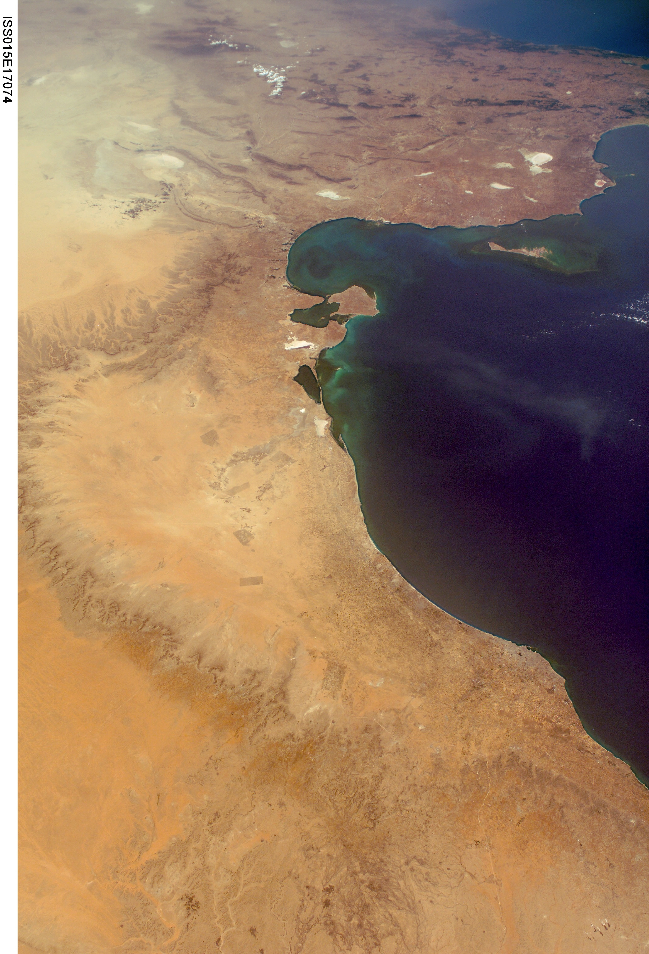
English: Image courtesy of Image Science and Analysis Laboratory, NASA-Johnson Space Center. "The Gateway to Astronaut Photography of Earth."
Crew Earth Observations NASA meatball eol.jsc.nasa.gov (03/30/2009 12:46:13). The Mediterranean coast of Tunisia and Libya. Main feature: the Gulf of Gabès with Kerkennah Islands and Djerba Island.Italiano: Image courtesy of Image Science and Analysis Laboratory, NASA-Johnson Space Center. "The Gateway to Astronaut Photography of Earth."
Crew Earth Observations NASA meatball eol.jsc.nasa.gov (03/30/2009 12:46:13). La costa del Mediterraneo di Tunisia e Libia. Particolare più importante: il Golfo di Gabès con le Isole Kerkennah e l'isola di Gerba. |
| Date | 7 July 2007 |
| Source | https://eol.jsc.nasa.gov/scripts/sseop/photo.pl?mission=ISS015&roll=E&frame=17074 |
| Author | Marco Bernardini |
Mission: ISS015 Roll: E Frame: 17074 Mission ID on the Film or image: ISS015
Country or Geographic Name: LIBYA
Features: G. OF GABES, COAST, TRIPOLI
Center Point Latitude: 33.0 Center Point Longitude: 12.0
Camera Tilt: High Oblique
Camera Focal Length: 28mm
Camera: E4: Kodak DCS760C Electronic Still Camera
Film: 3060E : 3060 x 2036 pixel CCD, RGBG array.
Date: 20070707 (YYYYMMDD)GMT Time: 140139 (HHMMSS)
Nadir Point Latitude: 30.0, Longitude: 15.9
Nadir to Photo Center Direction: Northwest
Sun Azimuth: 271
Spacecraft Altitude: 179 nautical miles (332 km)
Sun Elevation Angle: 49
Orbit Number: 1399
Licensing
| This file is in the public domain because it was created by NASA. NASA copyright policy states that "NASA material is not protected by copyright unless noted". (See Template:PD-USGov, NASA copyright policy page or JPL Image Use Policy.)
|
|
|
|
Warnings:
|
Public Domain
| EXIF data: | |
| File name | gulf_of_gabes_and_tripoli_from_iss.jpg |
|---|---|
| Size, Mbytes | 3.5442646484375 |
| Mime type | image/jpeg |
While the copyright and licensing information supplied for each photo is believed to be accurate, Free-Photos.biz does not provide any warranty regarding the copyright status or correctness of licensing terms. If you decide to reuse the images from Free-Photos.biz, you should verify the copyright status of each image just as you would when obtaining images from other sources.
The use of depictions of living or deceased persons may be restricted in some jurisdictions by laws regarding personality rights. Such images are exhibited at Free-Photos.biz as works of art that serve higher artistic interests.
PRIVACY POLICY
By registering your account and/or by subscribing to new and newly rated photographs you agree we may send you the links to photos and we may occasionally share other information with you.
We do NOT disclose your personal data.
