
Please login in order to download photos in full size
If you are not registered, please register for free: www.Free-Photos.biz/register
Please note to download premium images you also need to join as a free member..
You can also save the photos without the registration - but only in small and average sizes, and some of them will have the site's watermark. Please simply click your right mouse button and save the image.
Please login in order to like photos
If you are not registered, please register for free:
Sorry, non-members can download up to 100 full-size photos per month.
It looks like you have used up your limit.
Free members can download an unlimited number of full-size photos - including the premium free photos.
Join as a member today for FREE! - and download the images without limitations:
www.Free-Photos.biz/membership.php
You can also save the images without the membership - but only in small and average sizes, and some of them may have the site's watermark. Please simply click your right mouse button and save the image.
|
Download top free photographs!
This photo was viewed 28 times and was downloaded in full size 8 times.
This photo was liked 0 times


If you are a member, please login in order to see the source link of the above image.
|
| Description |
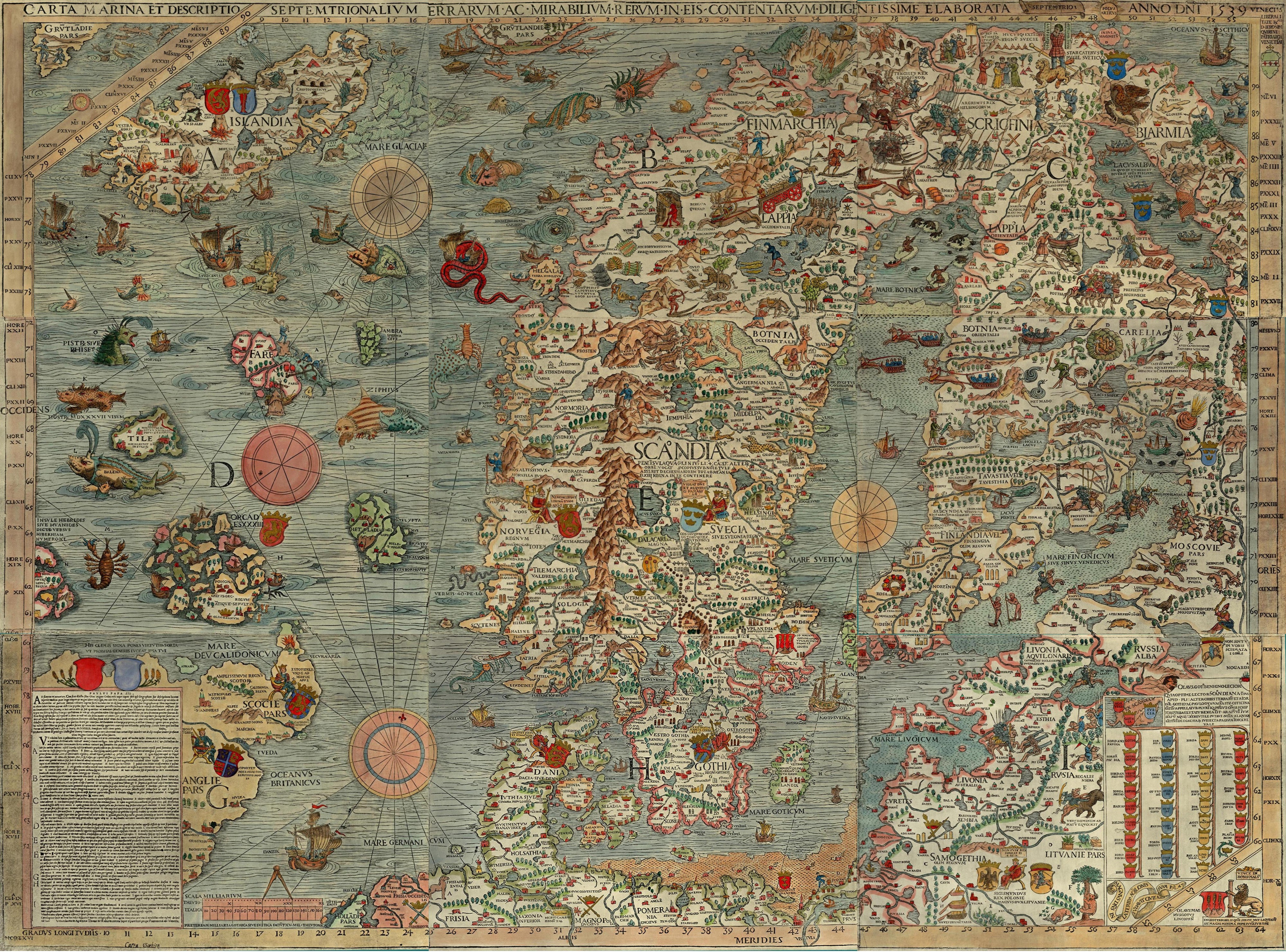
Deutsch: Carta marina, eine Landkarte Nordeuropas von Olaus Magnus. Die Überschrift lautet: Seekarte und Beschreibung der nördlichen Lande und der dort vorkommenden wunderlichen Dinge, höchst sorgfältig gezeichnet in Venedig im Jahre 1539 mit großzügiger Unterstützung des Patriarchen von Venedig, des höchst ehrenwerten Herrn Geronimo Querini.
English: Carta marina, a wallmap of w:Scandinavia, by Olaus Magnus. The caption reads : Marine map and Description of the Northern Lands and of their Marvels, most carefully drawn up at Venice in the year 1539 through the generous assistance of the Most Honourable Lord Hieronymo Quirino.
Español: La Carta Marina es un mapa de Escandinavia de gran tamaño hecho por Olaus Magnus. La leyenda dice: «Un mapa marino y descripción de las tierras nórdicas y de sus maravillas, dibujado cuidadosamente en Venecia en el año 1539 con la generosa ayuda del honorabilísimo Señor Hieronymo Quirino».
Français : La Carta Marina (Carte marine), une grande carte de la Scandinavie par Olaus Magnus. La legende de la carte precise : « carte marine et la description des terres septentrionales, de leurs merveilles, tracee avec diligence a Venise en l'an 1539 avec l'assistance genereuse du tres honorable seigneur Hieronimus Quirino ».
Latina: Carta marina et Descriptio septemtrionalium terrarum ac mirabilium rerum in eis contentarum, diligentissime elaborata Anno Domini 1539 Veneciis liberalitate Reverendissimi Domini Ieronimi Quirini.
Português: Carta marina uma mapa de grandes dimensões da Escandinávia, por Olaus Magnus. A legenda indica: Um mapa marinho e descrição das terras nórdicas e suas maravilhas, desenhado cuidadosamente em Veneza no ano de 1539 com a generosa ajuda do mui honorável Lord Hieronymo Quirino.
Suomi: Olaus Magnuksen Carta Marina, Pohjoismaiden kartta. Kartan otsikon suomennos: Merikartta ja kuvaus pohjoisista maista sekä niissä olevista ihmeellisistä asioista, mitä suurimmalla huolellisuudella valmistettu Herran vuonna 1539.
E: Rosmarus est bellua marina, ad magnitudinem Elephantis. Littorum montes scandit et gramine pascitur. Somni gracia dentibus se a rup suspendit, et adeo profundet dormit, ut piscatores laqueis et funibus victum comprehendant [1] |
|||||
| Date | ||||||
| Source | https://www.npm.ac.uk/rsdas/projects/carta_marina/ "Carta Marina satellite images" | |||||
| Author | Olaus Magnus | |||||
| Permission (Reusing this file) |
|
|||||
| Other versions |
Derivative works of this file: |
|||||
| This image was selected as picture of the day on Wikimedia Commons for . It was captioned as follows:
Afrikaans: Die Carta Marina, 'n muurkaart van Skandinawië (Olaus Magnus, 1539)
Asturianu: Carta Marina, mapa de los países nórdicos fechu por Olaus Magnus.
Bosanski: Carta marina (karta mora), zidna mapa Skandinavije autora Olausa Magnusa.
Čeština: Historická námořní mapa severní Evropy - Carta marina, autor: Olaus Magnus
Euskara: Carta Marina (latinez: itsasoko mapa), Olaus Magnusek eginiko eskandinaviako mapa.
Magyar: Carta marina, skandinávia falitérképe, Olaus Magnus munkája
Norsk bokmål: Carta Marina, veggkart over Norden av Olaus Magnus.
Norsk nynorsk: Carta Marina, veggkart over Norden av Olaus Magnus.
Suomi: Olaus Magnuksen Carta Marina, Pohjoismaiden kartta.
Беларуская: Насценная карта Скандынавіі «Карта Марына» (Олаўс Магнус, 1539).
Українська: Carta Marina Олафа Магнуса - настінна мапа Скандинавії.
中文: 15世纪的瑞典传教士大奥劳斯绘制的斯堪的那维亚半岛的海图。
|
Derivative versionsedit
-

detail
-
detail
-
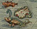
detail of Thule
-

detail showing Scandinavian tribes
-

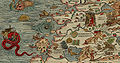
detail of maelstrom
-

Open navigation fires


Infoedit
- This image is in 72 DPI.
- Some info: Figure 1. The 1539 Carta Marina by Olaus Magnus. Please credit the James Ford Bell Library, University of Minnesota if you reproduce this map. There is also a high-resolution version (5 MB) for printing. Direct link to there: https://bell.lib.umn.edu/map/OLAUS/indexo.html or https://purl.umn.edu/94326
|
|
This picture made selected picture on Portal:Denmark, at EnWiki, in week 21, 2007 (view) |
|
|
This picture made selected picture on Portal:Denmark, at EnWiki, in week 22, 2007 (view) |
Carta marina, eine Landkarte Nordeuropas von Olaus Magnus. Die Überschrift lautet: Seekarte und Beschreibung der nördlichen Lande und der dort vorkommenden wunderlichen Dinge, höchst sorgfältig gezeichnet in Venedig im Jahre 1539 mit großzügiger Unterstützung des Patriarchen von Venedig, des höchst ehrenwerten Herrn Geronimo Querini. Carta marina, a wallmap of w:Scandinavia, by Olaus Magnus. The caption reads : Marine map and Description of the Northern Lands and of their Marvels, most carefully drawn up at Venice in the year 1539 through the generous assistance of the Most Honourable Lord Hieronymo Quirino. Español: La Carta Marina es un mapa de Escandinavia de gran tamaño hecho por Olaus Magnus. La leyenda dice: «Un mapa marino y descripción de las tierras nórdicas y de sus maravillas, dibujado cuidadosamente en Venecia en el año 1539 con la generosa ayuda del honorabilísimo Señor Hieronymo Quirino». Français : La Carta Marina (Carte marine), une grande carte de la Scandinavie par Olaus Magnus. La legende de la carte precise : « carte marine et la description des terres septentrionales, de leurs merveilles, tracee avec diligence a Venise en l'an 1539 avec l'assistance genereuse du tres honorable seigneur Hieronimus Quirino ». Latina: Carta marina et Descriptio septemtrionalium terrarum ac mirabilium rerum in eis contentarum, diligentissime elaborata Anno Domini 1539 Veneciis liberalitate Reverendissimi Domini Ieronimi Quirini. Português: Carta marina uma mapa de grandes dimensões da Escandinávia, por Olaus Magnus. A legenda indica: Um mapa marinho e descrição das terras nórdicas e suas maravilhas, desenhado cuidadosamente em Veneza no ano de 1539 com a generosa ajuda do mui honorável Lord Hieronymo Quirino. Suomi: Olaus Magnuksen Carta Marina, Pohjoismaiden ka
Public Domain
| EXIF data: | |
| File name | carta_marina.jpeg |
|---|---|
| Size, Mbytes | 5.345037109375 |
| Mime type | image/jpeg |
While the copyright and licensing information supplied for each photo is believed to be accurate, Free-Photos.biz does not provide any warranty regarding the copyright status or correctness of licensing terms. If you decide to reuse the images from Free-Photos.biz, you should verify the copyright status of each image just as you would when obtaining images from other sources.
The use of depictions of living or deceased persons may be restricted in some jurisdictions by laws regarding personality rights. Such images are exhibited at Free-Photos.biz as works of art that serve higher artistic interests.
PRIVACY POLICY
By registering your account and/or by subscribing to new and newly rated photographs you agree we may send you the links to photos and we may occasionally share other information with you.
We do NOT disclose your personal data.
