
Please login in order to download photos in full size
If you are not registered, please register for free: www.Free-Photos.biz/register
Please note to download premium images you also need to join as a free member..
You can also save the photos without the registration - but only in small and average sizes, and some of them will have the site's watermark. Please simply click your right mouse button and save the image.
Please login in order to like photos
If you are not registered, please register for free:
Sorry, non-members can download up to 100 full-size photos per month.
It looks like you have used up your limit.
Free members can download an unlimited number of full-size photos - including the premium free photos.
Join as a member today for FREE! - and download the images without limitations:
www.Free-Photos.biz/membership.php
You can also save the images without the membership - but only in small and average sizes, and some of them may have the site's watermark. Please simply click your right mouse button and save the image.
|

Download top free photographs!
This photo was viewed 30 times and was downloaded in full size 18 times.
This photo was liked 0 times


If you are a member, please login in order to see the source link of the above image.
Summaryedit
| Description |
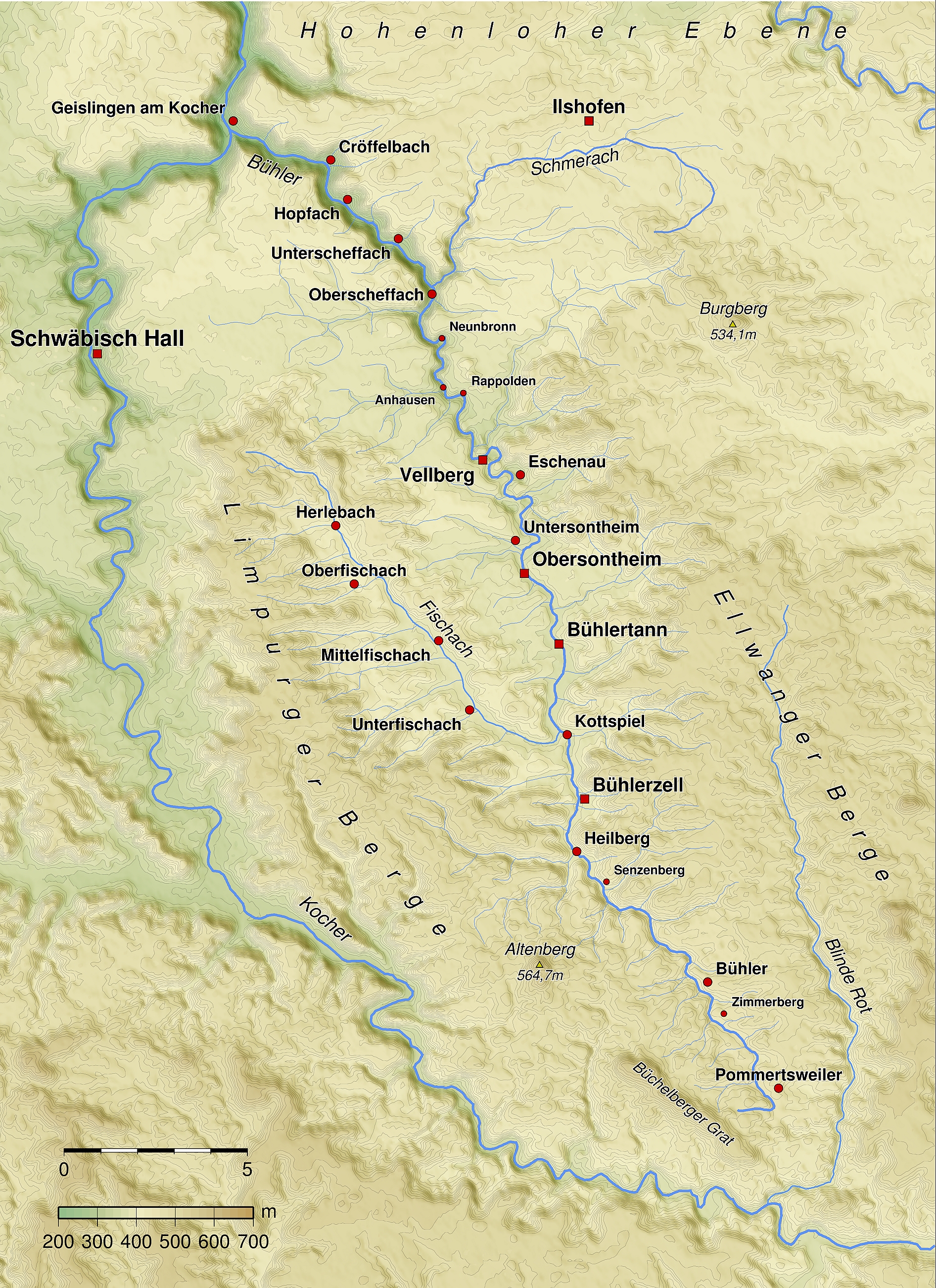
Deutsch: Karte des Verlaufs der Bühler und des überwiegenden Teils der in sie mündenden Bäche.
English: Map of the river Bühler including most of its tributaries
|
| Date | (original upload date) (Original text : 7. März 2009) |
| Source | Transferred from de.wikipedia; transferred to Commons by User:Rosenzweig using CommonsHelper. (Original text : Aus eigener Herstellung unter Verwendung von SRTM-Daten, Qgis, Generic Mapping Tools.) |
| Author | BerndH Original uploader was BerndH at de.wikipedia |
| Permission (Reusing this file) |
Released under the GNU Free Documentation License. |
Licensingedit
|
BerndH at the German language Wikipedia, the copyright holder of this work, hereby publishes it under the following license:
|


Original upload logedit

The original description page was here. All following user names refer to de.wikipedia.

- 2009-03-07 10:02 BerndH 1892×2603× (3402227 bytes) {{Information |Beschreibung = Karte des Verlaufs der Bühler und dem überwiegenden Teil der in sie mündenden Bäche. |Quelle = Aus eigener Herstellung unter Verwendung von SRTM-Daten, Qgis, Generic Mapping Tools. |Urheber = [[Benutzer:BerndH|BerndH]] |D
GNU Free Documentation License
| EXIF data: | |
| File name | buehler_karte.jpg |
|---|---|
| Size, Mbytes | 4.3956533203125 |
| Mime type | image/jpeg |
While the copyright and licensing information supplied for each photo is believed to be accurate, Free-Photos.biz does not provide any warranty regarding the copyright status or correctness of licensing terms. If you decide to reuse the images from Free-Photos.biz, you should verify the copyright status of each image just as you would when obtaining images from other sources.
The use of depictions of living or deceased persons may be restricted in some jurisdictions by laws regarding personality rights. Such images are exhibited at Free-Photos.biz as works of art that serve higher artistic interests.
PRIVACY POLICY
By registering your account and/or by subscribing to new and newly rated photographs you agree we may send you the links to photos and we may occasionally share other information with you.
We do NOT disclose your personal data.
