

Please login in order to download photos in full size
If you are not registered, please register for free: www.Free-Photos.biz/register
Please note to download premium images you also need to join as a free member..
You can also save the photos without the registration - but only in small and average sizes, and some of them will have the site's watermark. Please simply click your right mouse button and save the image.
Please login in order to like photos
If you are not registered, please register for free:
Sorry, non-members can download up to 1100 full-size photos per month.
It looks like you have used up your limit.
Free members can download an unlimited number of full-size photos - including the premium free photos.
Join as a member today for FREE! - and download the images without limitations:
www.Free-Photos.biz/membership.php
You can also save the images without the membership - but only in small and average sizes, and some of them may have the site's watermark. Please simply click your right mouse button and save the image.
|
This is a premium free photo
This photo was viewed 1 times and was downloaded in full size 1 times.
This photo was liked 0 times


If you are a member, please login in order to see the source link of the above image.
Summaryedit
| Artist |
|
||||||||||||||||||||
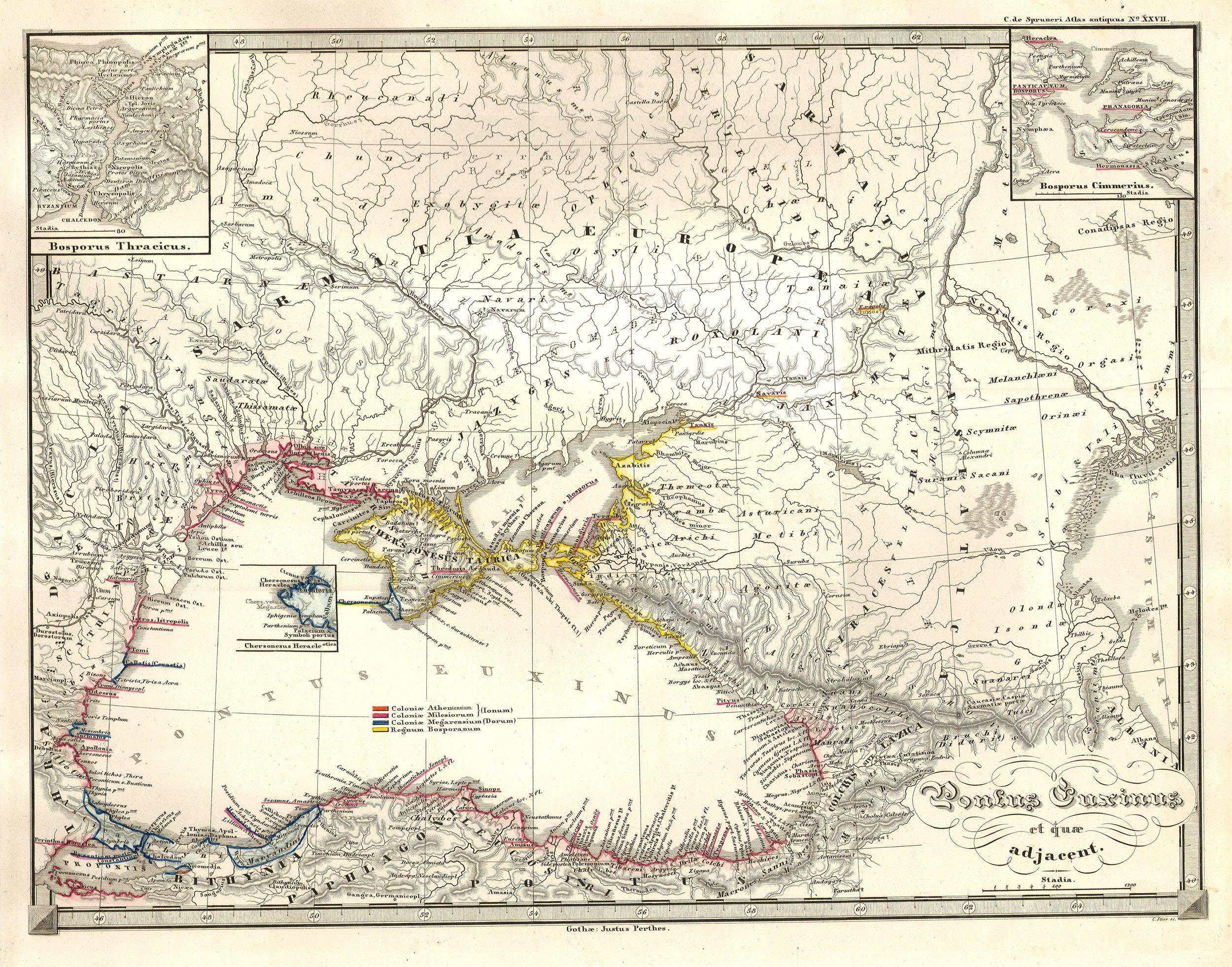
| Title | Pontus Euxinus et quae adjacent. | ||||||||||||||||||||
| Description |
English: This fine hand colored map is an 1855 steel plate lithograph depicting the Black Sea or Pontus Euxinus and vicinity. Depicts from the Propontis eastward to the Caspian Sea and northward as far as Castle Darin in modern day Ukraine. Features three inset maps. Inset in the upper left quadrant features the Bosporus Thracicus (Black Sea Side), inset in the upper right quadrant features the Bosphorus Cimmerius (Mediterranean Side). A third inset, in the center right zone, features the Chersonesus Heracle . Text in Latin. Prepared by Justus Perthes as plat no. 27 for Carl von Spruner’s Atlas Antiquus” .
|
||||||||||||||||||||
| Date | (undated) | ||||||||||||||||||||
| Dimensions | Height: 13 in (33 cm). Width: 16 in (40.6 cm). | ||||||||||||||||||||
| Accession number | Geographicus code: PontusEuxinus-spruneri-1855 | ||||||||||||||||||||
| Source/Photographer |
Atlas Antiquus. (1855 edition)
|
||||||||||||||||||||
| Permission (Reusing this file) |
|
||||||||||||||||||||

Licensingedit
This photographic reproduction is therefore also considered to be in the public domain. In other jurisdictions, re-use of this content may be restricted; see Reuse of PD-Art photographs for details. |
||||
Public Domain
| EXIF data: | |
| File name | 1855_spruneri_map_of_the_black_sea_or_pontus_euxinus_in_ancient_times_-_geographicus_-_pontuseuxinus-spruneri-1855.jpg |
|---|---|
| Size, Mbytes | 1.3973134765625 |
| Mime type | image/jpeg |
While the copyright and licensing information supplied for each photo is believed to be accurate, Free-Photos.biz does not provide any warranty regarding the copyright status or correctness of licensing terms. If you decide to reuse the images from Free-Photos.biz, you should verify the copyright status of each image just as you would when obtaining images from other sources.
The use of depictions of living or deceased persons may be restricted in some jurisdictions by laws regarding personality rights. Such images are exhibited at Free-Photos.biz as works of art that serve higher artistic interests.
PRIVACY POLICY
By registering your account and/or by subscribing to new and newly rated photographs you agree we may send you the links to photos and we may occasionally share other information with you.
We do NOT disclose your personal data.
