

Please login in order to download photos in full size
If you are not registered, please register for free: www.Free-Photos.biz/register
Please note to download premium images you also need to join as a free member..
You can also save the photos without the registration - but only in small and average sizes, and some of them will have the site's watermark. Please simply click your right mouse button and save the image.
Please login in order to like photos
If you are not registered, please register for free:
Sorry, non-members can download up to 1100 full-size photos per month.
It looks like you have used up your limit.
Free members can download an unlimited number of full-size photos - including the premium free photos.
Join as a member today for FREE! - and download the images without limitations:
www.Free-Photos.biz/membership.php
You can also save the images without the membership - but only in small and average sizes, and some of them may have the site's watermark. Please simply click your right mouse button and save the image.
|
This is a premium free photo
This photo was viewed 1 times and was downloaded in full size 0 times.
This photo was liked 0 times


If you are a member, please login in order to see the source link of the above image.
Summaryedit
| Description |
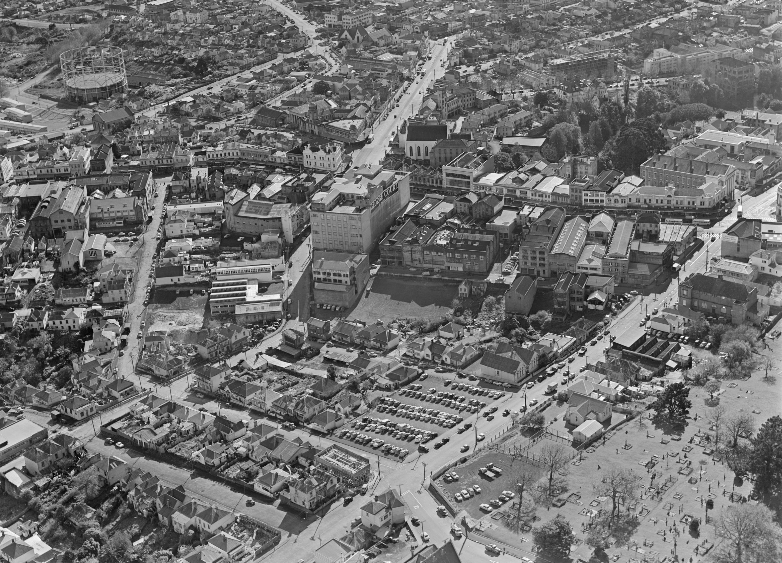
English: Looking northwest over Karangahape Road at the southern end of what will be known as the Auckland CBD. Pitt Street running away into the northwest, Upper Queen Street in the front-foreground. Particular visible buildings are the gasometer in the northwest, and the 'George Court' department store in the left-centre. Coordinates approximate, somewhere above the eastern Central Motorway Junction of today.
Extended information on origin webpage reads: Aerial view of Karangahape Road and surrounding area, Auckland. Photograph taken 4 June 1957 by Whites Aviation. |
| Date | |
| Source | National Library of New Zealand (Alexander Turnbull Library). |
| Author | The National Library of New Zealand (Alexander Turnbull Library) states specifically that the author is unknown. See relevance of this below. |
| Permission (Reusing this file) |
See below. It should be noted that NZ copyright provides a term of 50 years after the author's death/publication by a corporation. Therefore, based on the publication date, this document is in the public domain. |
| Other versions |
There is a higher-quality version of at least twice the detail. However, in their misguided attempt to claim copyright even over images that have fallen out of copyright like this one, the website prevents easy downloads. |
|
Camera location |
|
View this and other nearby images on: | (Info) |
|---|
Licensingedit
1 Some government publications are not subject to copyright, including bills, acts, regulations, court judgments, royal commission and select committee reports, etc. See references [1] or [2] for the full list. |
|
|||||||||||||||||||
Public Domain
| EXIF data: | |
| File name | karangahape_road_aerial_photo_in_1957.jpg |
|---|---|
| Size, Mbytes | 2.84086328125 |
| Mime type | image/jpeg |
While the copyright and licensing information supplied for each photo is believed to be accurate, Free-Photos.biz does not provide any warranty regarding the copyright status or correctness of licensing terms. If you decide to reuse the images from Free-Photos.biz, you should verify the copyright status of each image just as you would when obtaining images from other sources.
The use of depictions of living or deceased persons may be restricted in some jurisdictions by laws regarding personality rights. Such images are exhibited at Free-Photos.biz as works of art that serve higher artistic interests.
PRIVACY POLICY
By registering your account and/or by subscribing to new and newly rated photographs you agree we may send you the links to photos and we may occasionally share other information with you.
We do NOT disclose your personal data.
