

Please login in order to download photos in full size
If you are not registered, please register for free: www.Free-Photos.biz/register
Please note to download premium images you also need to join as a free member..
You can also save the photos without the registration - but only in small and average sizes, and some of them will have the site's watermark. Please simply click your right mouse button and save the image.
Please login in order to like photos
If you are not registered, please register for free:
Sorry, non-members can download up to 1100 full-size photos per month.
It looks like you have used up your limit.
Free members can download an unlimited number of full-size photos - including the premium free photos.
Join as a member today for FREE! - and download the images without limitations:
www.Free-Photos.biz/membership.php
You can also save the images without the membership - but only in small and average sizes, and some of them may have the site's watermark. Please simply click your right mouse button and save the image.
|
This is a premium free photo
This photo was viewed 3 times and was downloaded in full size 0 times.
This photo was liked 0 times


If you are a member, please login in order to see the source link of the above image.
Summaryedit
| Description |
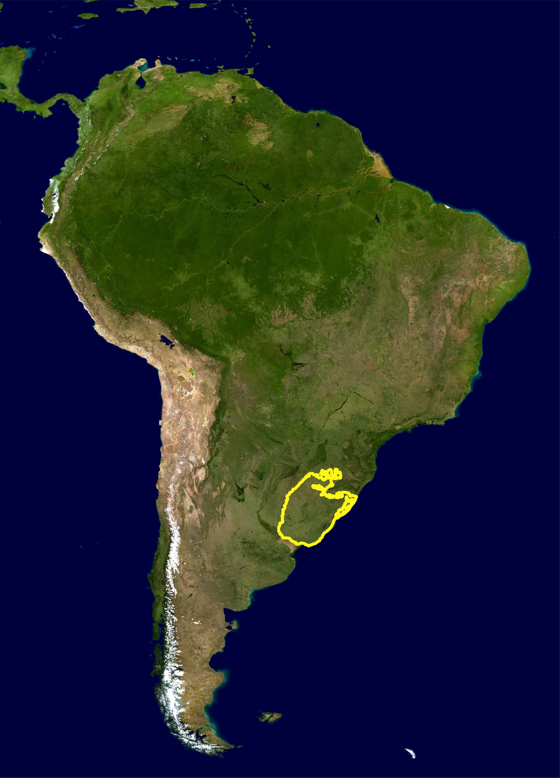
English: This is a map location of the Uruguayan savanna or Pampa. The yellow line encloses limits as delineated by the World Wide Fund for Nature. I, Miguelrangeljr, made it using NASA Blue Marble imagery and Corel Draw X6.
Português: Este mapa mostra a localização da ecorregiao dos Pampas ou Savana Uruguaia. A linha amarela delimita essa ecorregião como definida pelo WWF. Eu,Miguelrangeljr, fiz isso usando uma mapa de satélite da NASA e o corel Draw X6, usando como referência o mapa de ecorregiões do WWF: https://www.worldwildlife.org/science/wildfinder/
|
|||||
| Date | ||||||
| Source | NASA plus my editions by myself Visible Earth | |||||
| Author | NASA and Miguelrangeljr | |||||
| Permission (Reusing this file) |
|
Licensingedit
| This file is in the public domain because it was solely created by NASA. NASA copyright policy states that "NASA material is not protected by copyright unless noted". (See Template:PD-USGov, NASA copyright policy page or JPL Image Use Policy.) |
|
 |
Warnings:
|
Public Domain
| EXIF data: | |
| File name | uruguayn_savannah_wwf.jpg |
|---|---|
| Size, Mbytes | 0.5984775390625 |
| Mime type | image/jpeg |
| Date and time original image was generated | 2012:08:19 14:49:53 |
| Date and time image was made digital data | 2012:08:19 14:49:53 |
While the copyright and licensing information supplied for each photo is believed to be accurate, Free-Photos.biz does not provide any warranty regarding the copyright status or correctness of licensing terms. If you decide to reuse the images from Free-Photos.biz, you should verify the copyright status of each image just as you would when obtaining images from other sources.
The use of depictions of living or deceased persons may be restricted in some jurisdictions by laws regarding personality rights. Such images are exhibited at Free-Photos.biz as works of art that serve higher artistic interests.
PRIVACY POLICY
By registering your account and/or by subscribing to new and newly rated photographs you agree we may send you the links to photos and we may occasionally share other information with you.
We do NOT disclose your personal data.
