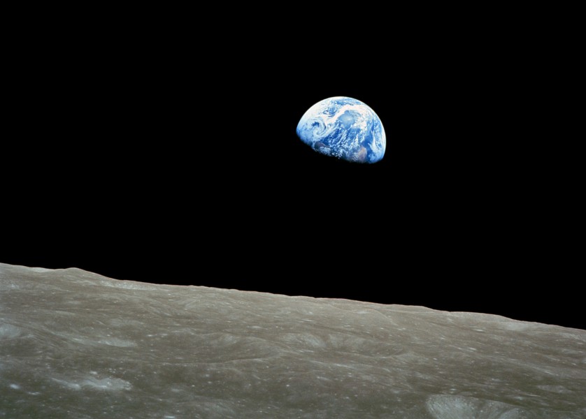
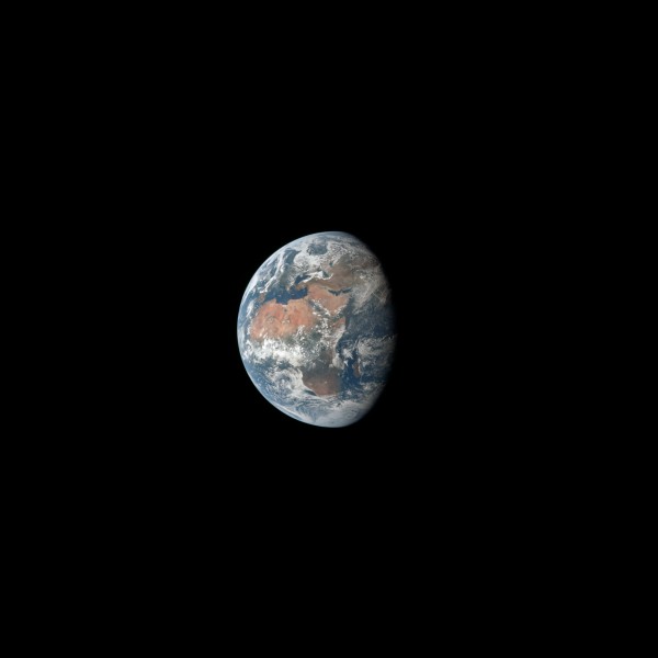
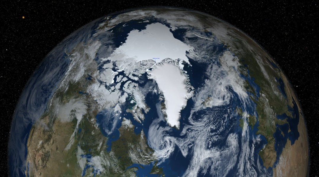
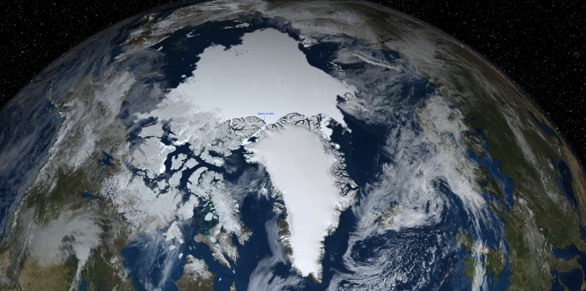
This very high resolution image shows a global view of the Earth with the northern hemisphere in view showing the Arctic sea ice on September 15, 2008. The extent of the sea ice was determined by the AMSR-E sea ice concentration data. The terrain shows the average land cover for September 2004 over the continents (see Blue Marble Next Generation). The global cloud cover shown was obtained from the original Blue Marble cloud data distributed in 2002 (see Blue Marble:Clouds).
Earth rising behind the moon
The mouths of the Ganges River seen in a specatcular view from the classified STS-27
Russia's Mir space station is backdropped over the blue and white planet Earth in this medium range photograph recorded during the final fly-around of the members of the fleet of NASA's shuttles. Seven crew members, including Andrew S.W. Thomas, were aboard the Space Shuttle Discovery when the photo was taken; and two of his former cosmonaut crewmates remained aboard Mir. Thomas ended up spending 141 days in space on this journey, including time aboard Space Shuttles Endeavour and Discovery, which transported him to and from Mir.
Death Valley as seen from the Space Shuttle's synthetic aperture radar instrument. This image is in false color; the surface color and intensity represent the radar reflection properties of the ground cover. The image is arranged like a map; the image pixels represent (approximately) rectangles on the ground.
The Nile and Egypt by day. Satellite photo from the en:ISS.
This astronaut photograph illustrates the unusual man-made landscape of the Pueblo Chemical Depot located near the city of Pueblo, Colorado.
abu_dhabi_from_space-iss006-e-32079-march_2003.jpg
The International Space Station is featured in this image photographed by an STS-132 crew member on space shuttle Atlantis after the station and shuttle began their post-undocking relative separation. Undocking of the two spacecraft occurred at 10:22 a.m. (CDT) on May 23, 2010, ending a seven-day stay that saw the addition of a new station module, replacement of batteries and resupply of the orbiting outpost.
iss-celestia.jpg
Artist representation of CERES instruments scan Earth in RAP Rotating Azimuth Plane mode.
earth-moon_system.jpg
the_blue_marble.jpg
Image taken on August 25, 1992 by NOAA GOES-7 weather satellite of the Americas and Hurricane Andrew as it makes landfall on the Louisiana coast.
Hurricane_off_Florida
Yaeyama Islands, Ryukyu Islandsin Okinawa, Japan
Sekisei Lagoon, Yaeyama Islands in Okinawa, Japan
kerkennah_islands_nasa.jpg
309th Aerospace Maintenance and Regeneration Group, Davis-Monthan AFB, Arizona - 16 May 1992
grtdivideco.jpg
sabine_lakeww.jpg
bluemarble-2001-2002.jpg
earth_western_hemisphere_white_background.jpg
San Andres Island from ISS
I hide the camera inside my skydiving suit and brought it out once the parachute was released.
Naval Historical Center archeologists have just completed a three-year (2000-200) archeological remote-sensing survey of U.S. Navy shipwreck lost off France’s coastline during the World War II Normandy invasion. The survey focused on locating Navy losses and the temporary harbors used in Neptune, the naval portion of Operation Overlord, codename for the Allied invasion of Europe, (D-Day), June 6, 1944. Cooperative effort between the Naval Historical Center, RESON (an off shore technology company), FUGRO (a company that makes navigation products), and the Center for Coastal and Ocean Mapping and Joint Hydrographic Center (CCOM) produced very detailed multibeam images for the survey such as this overview of the USS Susan B. Anthony (AP-72). The Susan B. Anthony, a troop transport, struck a sea-mine and san on June 7, 1944. The booms and damage to the number one hole (at the bow) are easy to see in this image. U. S. Navy photo.
A cloud-covered Earth from about 12,800 nautical miles away is seen in this color reproduction taken from the second TV transmission made by the color television camera on board the Apollo 10 spacecraft. The United States and Mexico are located at right center. The more cloud-free area is the western and southwestern part of the U.S. and northern Mexico. Clouds cover the eastern half of the U.S.
as08-16-2593.jpg
Big Blue Marble http://www.nasa.gov/vision/earth/features/blue_marble.html
One-third of the Earth's sphere illuminated, Earth's terminator, sunglint, a portion of east Africa, as photographed from the Apollo 11 spacecraft during its first lunar landing mission. While astronauts Neil A. Armstrong, commander, and Edwin E. Aldrin Jr., lunar module pilot, descended in the Lunar Module (LM)
Beautiful reflection of sunlight on the eastern Mediterranean Sea. No borders or conflict visible from space…just breath-taking beauty like this view of the island of Cyprus
earth___mir__sts-71_.jpg
Earth and Moon
The Earth and the Moon see by MESSENGER.
Mosaic of Earth by images taken during Mariner 10 departure from Earth-Moon system.
earth_eastern_hemisphere.jpg
earth_from_space.jpg
Viewed from space, the most striking feature of our planet is the water. In both liquid and frozen form, it covers 75% of the Earth’s surface. It fills the sky with clouds. Water is practically everywhere on Earth, from inside the rocky crust to inside our cells.
This detailed, photo-like view of Earth is based largely on observations from the Moderate Resolution Imaging Spectroradiometer (MODIS) on NASA’s Terra satellite. It is one of many images of our watery world featured in a new story examining water in all of its forms and functions. Here is an excerpt: “In all, the Earth’s water content is about 1.39 billion cubic kilometers (331 million cubic miles), with the bulk of it, about 96.5%, being in the global oceans. As for the rest, approximately 1.7% is stored in the polar icecaps, glaciers, and permanent snow, and another 1.7% is stored in groundwater, lakes, rivers, streams, and soil. Only a thousandth of 1% of the water on Earth exists as water vapor in the atmosphere. Despite its small amount, this water vapor has a huge influence on the planet. Water vapor is a powerful greenhouse gas, and it is a major driver of the Earth’s weather and climate as it travels around the globe, transporting heat with it.
For human needs, the amount of freshwater for drinking and agriculture is particularly important. Freshwater exists in lakes, rivers, groundwater, and frozen as snow and ice. Estimates of groundwater are particularly difficult to make, and they vary widely. Groundwater may constitute anywhere from approximately 22 to 30% of fresh water, with ice accounting for most of the remaining 78 to 70%.”
earth_western_hemisphere.jpg
earth-apollo10.jpg
earth-moon_reduc.jpg
Image of Earth from Galileo spacecraft
The Earth, photographed in far-ultraviolet light (1304 Angstrom) by Astronaut John W. Young, Apollo 16 commander, with the ultraviolet camera. The auroral belts 13 degrees either side of the magnetic equator can be seen crossing each other on the middle of the right side of the Earth.
Original Caption Released with Image: This color image of the Earth was obtained by Galileo at about 6:10 a.m. Pacific Standard Time on Dec. 11, 1990, when the spacecraft was about 1.3 million miles from the planet during the first of two Earth flybys on its way to Jupiter. The color composite used images taken through the red, green and violet filters. South America is near the center of the picture, and the white, sunlit continent of Antarctica is below. Picturesque weather fronts are visible in the South Atlantic, lower right. This is the first frame of the Galileo Earth spin movie, a 500- frame time-lapse motion picture showing a 25-hour period of Earth's rotation and atmospheric dynamics.
iss_complete_artist_impression.jpg
Mir and the Moon, two satellites of the Earth :While orbiting the planet during their June 1998 mission, the crew of the Space Shuttle Discovery photographed this view of two moons of Earth. Thick storm clouds are visible in the lovely blue planet's nurturing atmosphere and, what was then Earth's largest artificial moon, the spindly Russian Mir Space Station can be seen above the planet's limb. The bright spot to the right of Mir is Earth's very large natural satellite, The Moon. The Mir orbited planet Earth once every 90 minutes about 200 miles above the planet's surface or about 4,000 miles from Earth's center. The Moon orbits once every 28 days at a distance of about 250,000 miles from the center of the Earth.
A depiction of Earth from February 2002, view of America. Released in 2010 by NASA.
Earth's Horizon at 86,000 feet, photographed by an Amateur Radio High Altitude Ballooning flight.
Part of the Great Barrier Reef. Picture by Douglas Wheelock from the en:ISS.
The third planet from the sun in our solar system and is the only planet we know of that can sustain life.
Planets of the solar system
satellitenbild_der_erde_zusammengesetzt.jpg
sistema_solar__tierra_-_luna_.jpg
The earth seen from the outer space.Created with 3Ds max
world_upside_down.jpg
A bank of clouds over the western Pacific Ocean was photographed by Astronaut Frank Borman and James A. Lovell during the Gemini 7 mission. In the background the moon can be seen.
Satellite picture of Torino, in the region of Piedmont, northwestern Italy.
NASA's Long Duration Exposure Facility as seen during a photographic survey after it's retrieval by Columbia on mission STS-32. visible is the bay and town of LГјderitz in the top left corner.
NASA landscape image showing the Lobau (nort of the Danube River) and the Schwechat Airport, east of Vienna, Austria.
This is a detailed astronaut photograph illustrates flooding in metropolitan suburbs of the Brisbane, Queensland, Australia. Please note that the top of the photo is oriented approximately to the South-West and not to the North. The image, taken by astronauts on board the International Space Station, highlights several suburbs along the Brisbane River in the southern part of the Brisbane metropolitan area. The light-coloured rooftops of residences and other structures contrast sharply with green vegetation and brown, sediment laden flood-waters. Most visible low-lying areas are inundated by flood-water, perhaps the most striking being Rocklea at image upper left. The suburb of Yeronga (image lower left) also has evident regions of flooding, as does a park and golf course located along a bend in the Brisbane River to the south of St. Lucia (image center). Flooding becomes less apparent near the higher elevations of Mt. Coot-Tha at image right.
A colorful view of airglow layers at Earth's horizon is featured in this image photographed by a STS-122 crewmember on the Space Shuttle Atlantis.
This photograph, acquired in February 1984 by an astronaut aboard a space shuttle, shows a series of mature thunderstorms located near the Parana River in southern Brazil. With abundant warm temperatures and moisture-laden air in this part of Brazil, large thunderstorms are commonplace. A number of overshooting tops and anvil clouds are visible at the tops of the clouds. Storms of this magnitude can drop large amounts of rainfall in a short period of time, causing flash floods.
NASA astronaut image of Abaiang Atoll, Gilbert Islands, Kiribati
NASA astronaut image of 'Abd al KЕ«ri, Socotra Archipelago, Yemen
acraman_crater_australia.jpg
NASA astronaut image of Abemama Atoll, Gilbert Islands, Kiribati
The Adam's Bridge as seen between India and Sri Lanka, from Space Shuttle Endeavour during STS-59.
w:Adonara Island, Indonesia, with eruption plume from Ili Boleng volcano visible. Photographed from Space Shuttle, mission STS008.
Aerial view of Montreal-Pierre Elliot Trudeau International Airport
NASA atronaut image of North Agalega Island (Mauritius) in the Indian Ocean
This astronaut photograph illustrates the diverse agricultural landscape in the western part of Minas Gerais state in Brazil. The fields in this image are located south-west of the city of Perdizes, which means “partridges” in Portuguese. A mix of regularly-gridded polygonal fields and circular centre-pivot fields marks the human use of the region. Small streams (and their adjacent floodplains) of the Araguari River extend like fingers throughout the landscape. The visual diversity of the field forms is matched by the variety of crops: sunflowers, wheat, potatoes, coffee, rice, soybeans, and corn are among the products of the region. While the Northern Hemisphere is still in the grip of winter, crops are growing in the Southern Hemisphere, as indicated by the many green fields. Fallow fields—not in active agricultural use—display the violet, reddish, and light tan soils common to this part of Brazil. Darker soils are often rich in iron and aluminum oxides, and are typical of highly weathered soil that forms in hot, humid climates.
NASA Space Shuttle image of Agrihan island in the Northern Mariana Islands.
NASA Astronaut Image of Ahe Atoll(Tuamotu Archipelago, French Polynesia) in the Pacific Ocean
Ahunui Atoll, Tuamotu Archipelago, French Polynesia
NASA astronaut image of Ahunui Atoll (Tuamotu Archipelago, French Polynesia) in the Pacific Ocean
NASA Astronaut Image of Ailinginae Atoll (Ralik Chain, Marshall Islands) in the Pacific Ocean
NASA astronaut image of Ailinglaplap Atoll, Marshall Islands
NASA Astronaut Image of Ailuk Atoll (Ratak Chain, Marshall Islands) in the Pacific Ocean
Akutan Island (Aleuten)
Arrecife AlacrГЎn (atoll), Campeche Bank, Gulf of Mexico
NASA astronaut image of Aldabra Group (Seychelles) in the Indian Ocean
NASA astronaut image of Alamagan Island, Northern Mariana Islands
Aleutian Islands/Amchitka Island from Space
Aleutian Islands/Great Sitkin Island
Herbert Island (Aleutian Islands)
Herbert Island, Aleutian Islands
Aleutian Islands/Kagamil Island
Aleutian Islands/Little Sitkin Island
Aleutian Islands/Sedanka Island
Aleutian Islands/Seguam Island
Aleutian Islands/Segula Island
Aleutian Islands/Chugul Island
Umak Island (Aleutian Islands)
Aleutian Islands/Yunaska Island
Aleutian Islands from space A photograph of Atka Island, Amlia Island, and other parts of the Aleutian chain, Alaska. Taken on the STS-56 shuttle mission, in April 1993. Image number: STS056-071-031 The oval, snow-covered northern peninsula of Atka Island, a cluster of severely eroded stratovolcanoes and caldera, is part of the Aleutian chain known as the Central Aleutian Islands. Korovin Volcano, near the northern edge of the island, has the highest elevation on the island [5030 feet (1533 meters)] and the most eruptive activity. Elongated, east-west-oriented Amlia Island to the east rises only 2100 feet (640 meters) at its highest elevation.
Alexandria, Egypt - March 1990
Imagen de satГ©lite de la costa de Algeciras, AndalucГ­a, EspaГ±a, desde 393 kilГіmetros de altura
Astronaut photo of the Algodones Dunes, at the borders of California, Arizona, and Mexico. The All-American Canal cuts across the southern end of the dunes and the Cargo Muchacho Mountains can be seen beneath cloud cover at the top of the scene. Remains of the Alamo Canal are located parallel to the left side of the Colorado River (center far right of image), with the intake still visible near Pilot Knob.
Astronaut photo of the w:Al Khufrah Oasis in Libya. The circular objects are agricultural fields. The shape is characteristic of w:center pivot irrigation. These fields are approximately 0.6 mile (1 kilometer) in diameter. Darker colors indicate fields where such crops as wheat and alfalfa are grown. Lighter colors can indicate a variety of agricultural processes: fields that have been harvested recently; fields that are lying fallow; fields that have just been planted; or fields that have been taken out of production.
almeria-invernaderos.jpg
Alutu volcano lies between light-brown Lake Mirrga (Lake Langano) on the south and greenish Lake Zway on the north. The volcano displays several craters aligned along NNE-SSW and E-W fissures. Dark-colored obsidian lava flows erupted from craters along the fissures have descended the flanks in all directions. Although the age of the most recent eruption of Alutu is not known, its eruptive products overlie recent basaltic lava flows to the west, and strong fumarolic activity continues.
NASA Astronaut Image of Amanu Atoll(Tuamotu Archipelago, French Polynesia) in the Pacific Ocean
Amanu Atoll, Tuamotu Archipelago, French Polynesia
A satellite image of a part of the Amazon River.
NASA Astronaut Image of Anaa Atoll (Tuamotu Archipelago, French Polynesia) in the Pacific Ocean
Waves of clouds along the east flanks of the Andes Mountains cast off an orange glow by the low angle of the sun in the West. The dark area to the left is the Earth's terminator. This view was photographed by astronaut Frank Borman and James A. Lovell during the Gemini 7 mission, looking South from Northern Bolivia across the Andes. The Intermontane Salt Basins are visible in the background.
NASA Astronaut Image of Aneityum, Vanuatu
Annenkov Island, South Georgia
NASA astronaut image of Anuanuraro (Tuamotu Archipelago, French Polynesia) in the Pacific Ocean
NASA Astronaut Image of Anuanurunga (Tuamotu Archipelago, French Polynesia) in the Pacific Ocean
The concentric ring structure of the Aorounga crater—renamed Aorounga South in the multiple-crater interpretation of SIR data—is clearly visible in this detailed astronaut photograph. The central highland, or peak, of the crater is surrounded by a small sand-filled trough; this in turn is surrounded by a larger circular trough. Linear rock ridges alternating with light orange sand deposits cross the image from upper left to lower right; these are called yardangs by geomorphologists. Yardangs form by wind erosion of exposed rock layers in a unidirectional wind field. The wind blows from the north-east at Aorounga, and sand dunes formed between the yardangs are actively migrating to the south-west.
Apataki Atoll, Palliser islands, Tuamotu Archipelago, French Polynesia
Apollo 7 photo of Florida (NASA)
appalachian_mountains_sts062-104-26.jpg
NASA astronaut image of Aranuka Atoll, Gilbert Islands, Kiribati
NASA astronaut image of Aratika Atoll (Tuamotu Archipelago, French Polynesia) in the Pacific Ocean
Foto satelital del ArchipiГ©lago de los Chonos, Chile.
NASA atronaut image of Arrecife Alacranes (Scorpion Reef), Gulf of Mexico
NASA astronaut image of Arorae Island, Gilbert Islands, Kiribati
ariquemes__rondonia__brasil_satelite.jpg
The municipality of Dubai is the largest city of the Persian Gulf emirate of the same name, and has built a global reputation for large-scale developments and architectural works. Among the most visible of these developments—particularly from the perspective of astronauts on board the International Space Station—are three human-made archipelagos. The two Palm Islands (Palm Jumeirah and Palm Jebel Ali) appear as stylized palm trees when viewed from above. The World Islands evoke a rough map of the world from an air- or space-borne perspective. Palm Jumeirah and the World Islands are highlighted in this astronaut photograph.
Palm Jumeirah (image lower left) was begun in 2001 and required more than 50 million cubic meters of dredged sand to raise the islands above the Persian Gulf sea level. Construction of the Palm Jumeirah islands was completed in 2006; the islands are now being developed for residential and commercial housing and infrastructure. Creation of the 300 World Islands (image upper right) was begun in 2003 and completed in 2008, using 320 million cubic meters of sand and 37 million tonnes of rock for the surrounding 27-kilometer-long protective breakwater. Little to no infrastructure development of The World is apparent in this astronaut photograph.
Also visible at the lower edge of the astronaut photograph is another notable structure—the Burj Khalifa (image lower right and rotated 90 degrees in inset). Burj Khalifa stands 800 meters (2,600 feet) high, and it is currently the world’s tallest structure. The astronaut photograph captures enough detail to make out the tapering outline of the building as well as its dark, needle-like shadow pointing towards the northeast.
NASA Astronaut Image of Arutua Atoll (Tuamotu Archipelago, French Polynesia) in the Pacific Ocean
NASA atronaut image of Aruba in the Caribbean Sea
Arutua Atoll, Tuamotu Archipelago, French Polynesia
Earth, photographed in far-ultraviolet light with the ultraviolet camera, by John W. Young
NASA astronaut image of Ascension Island, Atlantic Ocean
This oblique astronaut photograph from the International Space Station (ISS) captures a white-to-grey ash and steam plume extending westwards from the volcano. Oblique images are taken by astronauts looking out from the ISS at an angle, rather than looking straight downward toward the Earth (a perspective called a nadir view), as is common with most remotely sensed data from satellites. An oblique view gives the scene a more three-dimension quality, and provides a look at the vertical structure of the volcanic plume. While much of the island is covered in green vegetation, grey deposits that include pyroclastic flows and volcanic mud-flows (lahars) are visible extending from the volcano toward the coastline. When compared to its extent in earlier views, the volcanic debris has filled in more of the eastern coastline. Urban areas are visible in the northern and western portions of the island; they are recognizable by linear street patterns and the presence of bright building rooftops. The silver-grey appearance of the Caribbean Sea surface is due to sun-glint, which is the mirror-like reflection of sunlight off the water surface back towards the hand-held camera on-board the ISS. The sun-glint highlights surface wave patterns around the island.
NASA astronaut image of Assumption Island (belonging to Aldabra-Group, Outer Islands, Seychelles) in the Indian Ocean
Ashmore Reef, Satelite image by NASA (source: http://earth.jsc.nasa.gov/newsletter/CoralReefs/Ch11/STS060-75-25.htm)
During the first EVA of Apollo 17, Eugene Cernan photographed Harrison Schmitt with the American flag and the Earth,400 000km away,in the background. The chest-mounted RCU and the camera bracket are clearly visible. Cernan is visible in the reflection in Schmitt's helmet visor in the awkward position he assumed to obtain this image
NASA astronaut image of Astove Island (Aldabra Group, Seychelles) in the Indian Ocean
Satellite photo of Bangkok and Gulf of Thailand, featuring the Chao Phraya River (Center Point Latitude: 13.5 Center Point Longitude: 100.5), taken from ISS (ISS006)
Reliant Park Area, Houston, Texas Includes Astrodome & Reliant Stadium
NASA astronaut image of Asuncion Island, Northern Mariana Islands
Auckland International Airport as seen from the International Space Station by the crew of Expedition 5.
NASA atronaut image of Rocas Atoll (Brazil), Atlantic Ocean
Aurora Australis Observed From the International Space Station
Among the views of Earth afforded astronauts aboard the International Space Station (ISS), surely one of the most spectacular is of the aurora. These ever-shifting displays of colored ribbons, curtains, rays, and spots are most visible near the North (aurora borealis) and South (aurora australis) Poles as charged particles (ions) streaming from the Sun (the solar wind) interact with Earth’s magnetic field.
While aurora are generally only visible close to the poles, severe magnetic storms impacting the Earth’s magnetic field can shift them towards the equator. This striking aurora image was taken during a geomagnetic storm that was most likely caused by a coronal mass ejection from the Sun on May 24, 2010. The ISS was located over the Southern Indian Ocean at an altitude of 350 kilometers (220 miles), with the astronaut observer most likely looking towards Antarctica (not visible) and the South Pole.
The aurora has a sinuous ribbon shape that separates into discrete spots near the lower right corner of the image. While the dominant coloration of the aurora is green, there are faint suggestions of red left of image center. Dense cloud cover is dimly visible below the aurora. The curvature of the Earth’s horizon (the limb) is clearly visible, as is the faint blue line of the upper atmosphere directly above it (at image top center). Several stars appear as bright pinpoints against the blackness of space at image top right.
Auroras happen when ions in the solar wind collide with atoms of oxygen and nitrogen in the upper atmosphere. The atoms are excited by these collisions, and they typically emit light as they return to their original energy level. The light creates the aurora that we see. The most commonly observed color of aurora is green, caused by light emitted by excited oxygen atoms at wavelengths centered at 0.558 micrometers, or millionths of a meter. (Visible light is reflected from healthy (green) plant leaves at approximately the same wavelength.) Red aurora are generated by light emitted at a longer wavelength (0.630 micrometers), and other colors such as blue and purple are also sometimes observed.
The capital city of Iraq, Baghdad, located in a broad plain with a population of nearly 4 million, can be seen in this near-nadir view. The Tigris River is visible entering the scene from the upper left (north) traversing south through the city, and exiting the scene at the right center of the image (south). Canals are discernible throughout the view traversing through and around the city. Even after the Gulf War of early 1991, Baghdad remains the major commercial and industrial center of the country. The runways of the Baghdad International Airport are visible midway between the center and the bottom of the image (west of the city center).
NASA astronaut image of Aves Island (Venezuela) in the Caribbean
The island of Bahrain, together with platform reef structures. Active coral growth is limited to only small areas of these platforms
The Bay of La Paz.
Satelital image of Bahia EngaГ±o, Chubut, Argentina
Baikonur (Town) and Syrdarya River from top, 26 October 2002
NASA astronaut image of Baker Island in the Pacific Ocean
Lake Bakhtegan and Lake Tashk, Iran. Photo taken by crew of en:Space Shuttle Discovery, mission en:STS-92, Oct. 22, 2000.
The Harra of Bal Haf volcanic field fills much of this NASA Space Shuttle image taken along the Gulf of Aden in southern Yemen (with north to the lower left). Dark-colored lava fields cover much of the volcanic field and create an irregular shoreline. One fresh-looking basaltic flow may be of historical age. Two large tuff cones are visible along the coast at the upper left, one of which is lake filled. A road cuts across the volcanic field from the town of Bal Haf at the lower right.
NASA astronaut image of Band-e Amir River, Lake, Valley; Afghanistan
NASA satellite image of Aswan High Dam
NASA astronaut image of Barren Island (Andaman Islands, India) in the Indian Ocean
Astronaut made photograph of the Great Barrier Reef
Far Northern Section of the Great Barrier Reef. Northern Cooktown, Queensland: Cape Melville (right).
The image is oriented with north aproximately to the right.
China, Xinjiang, desert Lop Nur. Satellite picture of the Basin of the formerly sea Lop Nur in the Desert of Lop. In the foreground Kuruktagh, in the background Kumtagh and Astintagh. A duststorm is blowing to the west over the Desert of Lop. Two lakes appear in a break in the clouds covering the Plateau of Astintagh. Visible are elongated Ayakkum Hu Lake south-southwest of Lop Nur and small blue-green Gas Hu Lake.
en: China, Xinjiang, desert Lop Nur. Satellite picture of the Basin of the formerly sea Lop Nur in the Desert of Lop Nur. In the foreground Kuruktagh, in the background Kumtagh and Astintagh. de: China, Xinjiang, Wüste Lop Nor. Satellitenaufnahme von dem mittleren Teil des Seebeckens Lop Nor und der Wüste Lop Nor. Links im Vordergrund sieht man einen Teil des Gebirges Kuruktagh mit Kratern des Kernwaffentestgeländes, im Hintergrund die Hänge des Kumtagh und die Hochebene des Astintagh. Blick von Nordwesten Richtung Südosten.
NASA astronaut image of Bassas da India Atoll in the Indian Ocean
Gibraltar Bay, Western Mediterranean Sea.
NASA Astronaut image of Belep Island (New Caledonia) in the Pacific Ocean
The Bayuda volcanic field is located near the center of the Bayuda desert of NE Sudan. The numerous small cinder cones that trend horizontally across the center of the volcanic field in this Space Shuttle image were erupted along a WNW-trending line. Lava flows, one of which was erupted about 1100 years ago, are visible in this image, but about 10% of the vents are explosion craters. Bayuda was constructed over Precambrian and Paleozoic granitic rocks, which form the darker areas at the lower right.
STS045-153-0AD Beringa Island, Russia March 1992
The largest of the Komandorski Islands, the snow-covered island of Beringa (Bering) can be seen in this west-looking view. Beringa Island is located east of the Kamchatka Peninsula in the Bering Sea. The island is 55 miles (90 km) long and up to 15 miles (24 km) wide. Beringa is a treeless island with hills. The island is foggy and is prone to earthquakes. The scant population on the island is involved mostly in fishing.
Foto por satГ©lite da cidade de BelГ©m, PA - Brasil
Annotated astronaut photo of w:Belle Isle, Newfoundland and Labrador, Canada. Taken from the International Space Station.
NASA astronaut image of Beru Island, Gilbert Islands, Kiribati
Betsiboka River entering the Bombetoka Bay creating a delta. NASA photo.
Flooding in the Betsiboka river. Image acquired with a Nikon D2Xs digital camera fitted with a 400 mm lens.
The Betsiboka River. Image acquired with a Nikon D2Xs digital camera fitted with a 400 mm lens.
NASA astronaut image of Bickerton Island in Australia
Bikar Atoll, RMI, photographed from the ISS. The original image was trimmed and rotated to orient the top of the image approximately to true North.
The otherworldly footprint of black basaltic lava creates a striking landscape at Black Point Lava Flow in northern Arizona, seen in this photograph taken from the International Space Station. The eastern edge of the flow slumps down to the surrounding plain, and it ends along the Little Colorado River (lower right).
en: China, Xinjiang, Bosten Lake area. Satellite picture: 2. Nov. 2004. de: China, Xinjiang, Bosten-See. Satellitenaufnahme von dem Bosten-See am 2. November 2004. Blick von SГјden Richtung Norden.
NASA astronaut image of Bora Bora, Gesellschaftsinseln, French Polynesia
NASA astronaut image of Bouvet Island in the Southern Atlantic Ocean
A space view by the Shuttle from the Lazio region in Italy. The large dark round structure is Lake Bracciano, the central part of the Sabatini volcanic province.
Image Science and Analysis Laboratory, NASA-Johnson Space Center. 25 Mar. 2005.
Whether seen at night or during the day, the capital city of Brazil is unmistakable from orbit. Brasília is located on a plateau—the Planalto Central—in the west-central part of the country, and is widely considered to be one of the best examples of 20th century urban planning in the world. One of its most distinctive design features—as seen from above—suggests a bird, butterfly, or airplane travelling along a north-west south-east direction, and is made dramatically visible by city light patterns (image centre right, between Lake Paranoá and the airport). The developed areas of Brasília and its satellites are clearly outlined by street grids and highway lights in this astronaut photograph taken from the International Space Station. The large unlit region to the upper right is the Brasília National Park. Other dark regions to the bottom and left include agricultural fields and expanses of the Cerrado tropical savanna.
satellite image of the Brisbane Metropolitan Area and surrounding Islands of Moreton Bay
NASA astronaut image of part of Butaritari Atoll, Gilbert Islands, Kiribati
BrГјggen Glacier and surroundig area, Chile
cabeco_gordo_y_caldera_de_faial.jpg
The built-up areas of Cabo (cape) San Lucas stand out as bright, angular areas inland from the main bay on the tip of the Baja California peninsula. The town is nearly centered on the bay, which looks out onto the blue waters of the Gulf of California. Three dry river beds (white sands in this arid environment) descend from rugged, wooded hills to the coastline. River sands then accumulate to form the white beaches visible along the coastline adjacent to the city.

Cabo San Lucas, once just a collection of fishing villages, is now a tourist hotspot (current population 41,000), known for its mild, sunny winter weather. It has grown rapidly in the past few decades, with new neighborhoods sprawling north and northwest (indicated with lines) along major roads. Larger developments stretch northeast along the coast for 40 kilometers from Cabo San Lucas to the slightly larger city of San José del Cabo (not visible). Whale watching competes with marlin fishing as one of the area’s most popular activities.
Annotated image of w:Cabo San Lucas, Mexico, taken from the International Space Station.
Astronaut photo of the confluence of the Mississippi and Ohio Rivers at Cairo, Illinois.
A complex of snow-covered cones (left-center) partially fills the 30 x 45 km wide Caldera del Atuel, which lies just east of the Argentina-Chile border. The headwaters of the RГ­o del Atuel drain to the SE through a wide breach in the caldera rim (top center) in this NASA International Space Station image (with north to the bottom left). The snow-covered VolcГЎn Overo and Sosneado complexes in the eastern part of the caldera contain numerous very youthful basaltic-to-andesitic pyroclastic cones and lava flows.
Cam Ranh Bay aerial view from NASA satellite.
camp_de_morvedre__fotografia_sata_la_lit_.jpg
Cape Henlopen, Delaware, USA - October 1994
The arm-shaped peninsula of Massachusetts is shown here in a digital photograph from astronauts aboard the International Space Station.
Cape Kazantip is a prominent headland on the Kerch Peninsula, which defines the southern shore of the Sea of Azov and the east extension of the Crimean Peninsula. During the Second World War, German and Soviet forces fought on the Kerch Peninsula, with the line of battle impinging on areas shown at the bottom of the image. The distance from the tip of the Cape to the largest local city, Lenine (population ~70,000, image lower left) is only 20 kilometres.
Cropped image of NASA picture of en:Caroline Atoll (ISS002-E-6368), showing only the Central Leeward Islets
NASA atronaut image of the central part of Cargados Carajos Shoals (Mauritius) in the Indian Ocean
Cropped image of NASA picture of Caroline Atoll (ISS002-E-6368), showing only the Southern Nake Islets.
Cropped image of NASA picture of Caroline Atoll (ISS002-E-6368), showing only the Southern Leeward Islets.
Cropped image of NASA picture of Caroline Atoll (ISS002-E-6368), showing only Long Islet
Cropped image of NASA picture of Caroline Atoll (ISS002-E-6368), showing only the Windward Islets.
Cropped image of NASA picture of Caroline Atoll (ISS002-E-6368), showing only Nake Islet.
Cropped image of NASA picture of Caroline Atoll (ISS002-E-6368), showing only South Islet.
Astronauts on the International Space Station took in this view of the north coast of the Caspian Sea and two river deltas in Kazakhstan and Russia on September 11, 2010. The larger delta (image middle) is that of the Volga River, which appears prominently in sunglint—light reflected off a water surface back towards the observer—and the smaller, less prominent delta is the Ural River (lower left).
The smoke plume appears to rise out of coastal marsh vegetation in the Ural River delta, rather than a city or oil storage facility. Although even small fires produce plumes that are long, bright, and easily visible from space, the density of the smoke in this plume—which stretches 350 kilometers (217 miles)—suggests it was a significant fire. The smoke was thick enough near the source to cast shadows on the Caspian Sea surface below. Lines mark three separate pulses of smoke: the most recent, nearest the source, extends directly south from the coastline. With time, plumes become progressively more diffuse. The oldest pulse appears thinnest, casting no obvious shadows.
Wide-angle, oblique views such as this—taken looking outward at an angle, rather than straight down towards the Earth—give an excellent impression of how ISS astronauts view the Earth. For a sense of scale, the Caucasus Mountains, across the Caspian, are approximately 1,100 kilometers (680 miles) to the southwest of the space station’s nadir point—the location on Earth directly underneath the spacecraft—at the time this image was taken.
cartagena__mar_menor__i_cap_de_pals__foto_sata_la_lit_.jpg
Astronaut photo of w:Cayo Largo del Sur, Cuba.
Photos of Earth from Space [1-200]
Photos of Earth from Space [201-400]
Photos of Earth from Space [401-600]
Photos of Earth from Space [601-800]
Photos of Earth from Space [801-1000]


Photos offered at Free-Photos.Biz come from Wikimedia Commons and from other sources. The pictures are published under free licenses and can be used by you free of charge for commercial and non-commercial purposes.
See more at: here and here.If you want to be sure of the concrete free license of a picture - look for the same picture at commons.wikimedia.org and see the license conditions there - but remember not all pictures come from there.

Some photos portray identifiable persons alive or deceased recently. The use of images of living or recently deceased individuals is, in some jurisdictions, restricted by laws pertaining to personality rights, independent from their copyright status. Before using such photos, please ensure that you have the right to use them under the laws which apply in the circumstances of your intended use. You are solely responsible for ensuring that you do not infringe someone else's personality rights.
christian portal