

Please login in order to download photos in full size
If you are not registered, please register for free: www.Free-Photos.biz/register
Please note to download premium images you also need to join as a free member..
You can also save the photos without the registration - but only in small and average sizes, and some of them will have the site's watermark. Please simply click your right mouse button and save the image.
Please login in order to like photos
If you are not registered, please register for free:
Sorry, non-members can download up to 1100 full-size photos per month.
It looks like you have used up your limit.
Free members can download an unlimited number of full-size photos - including the premium free photos.
Join as a member today for FREE! - and download the images without limitations:
www.Free-Photos.biz/membership.php
You can also save the images without the membership - but only in small and average sizes, and some of them may have the site's watermark. Please simply click your right mouse button and save the image.
|
This is a premium free photo
This photo was viewed 1 times and was downloaded in full size 0 times.
This photo was liked 0 times


If you are a member, please login in order to see the source link of the above image.
Summary
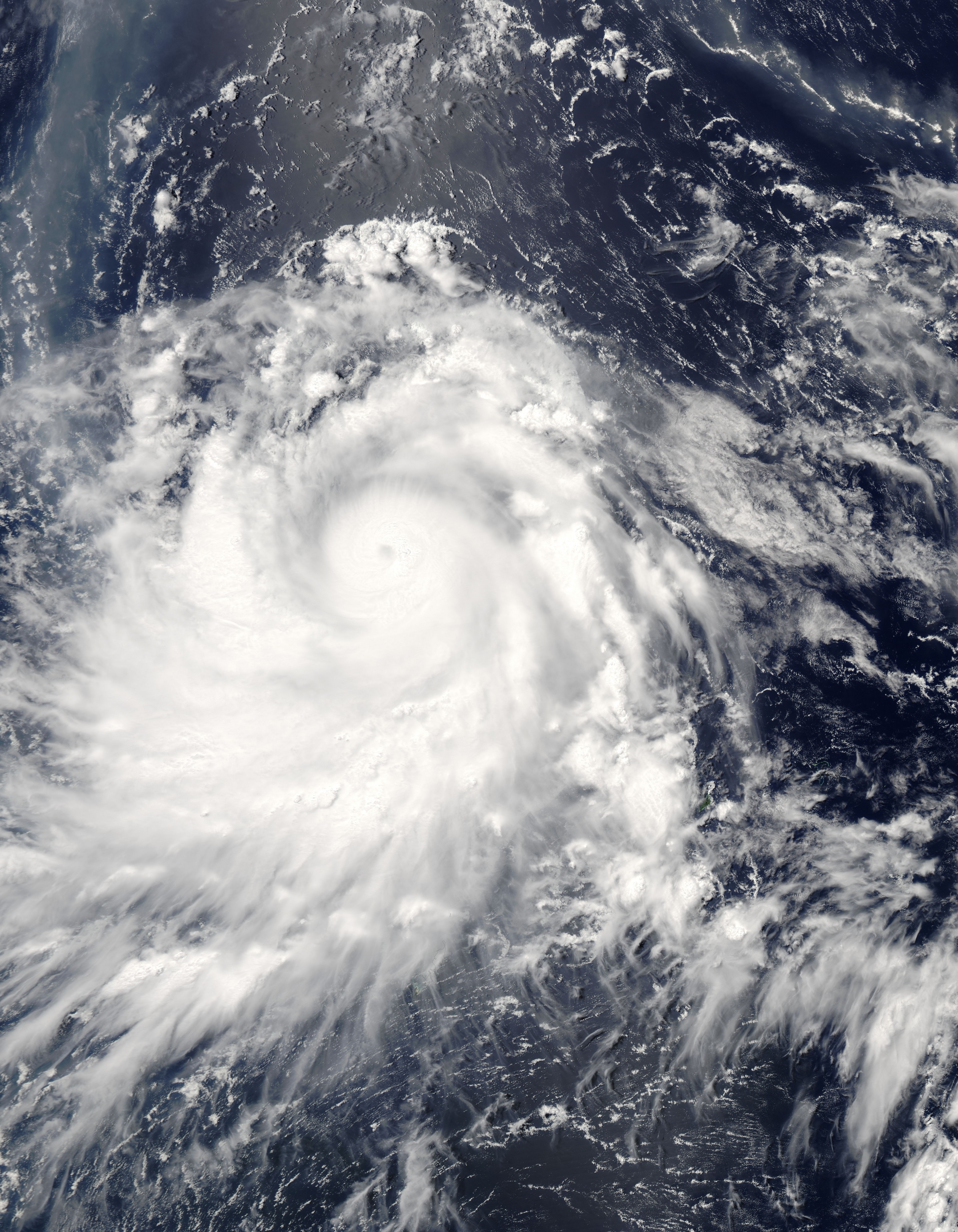
| Description | Typhoon Nesat spins over the Philippine Sea in this Moderate Resolution Imaging Spectroradiometer (MODIS) image acquired on June 3, 2005, by NASA’s Aqua satellite. At the time, Nesat had winds of 213 kilometers per hour (132 mph) with gusts to 259 kph (161 mph), making it the equivalent of a Category 4 hurricane. The storm formed near Guam on May 30 and moved slowly west northwest over the following four days. On June 3, Nesat skirted the Philippines as it curved northeast towards Japan. It is expected to miss the island nation as it moves east over the North Pacific. To the north of the typhoon, a white and brown plume of ash and steam drifts across the ocean from the Anatahan volcano. Located in the Northern Mariana Islands, just beyond the right edge of the image and immediately north of where Nesat formed, the volcano has been erupting for much of 2005. The ash plume cuts northwest across the upper right corner of the image, then curves sharply down across the upper left corner of the image. To the left of the center of the image, a silvery strip is formed by the reflection of the sun off the water’s surface. | |||||
| Date | 3 June 2005 | |||||
| Source | https://visibleearth.nasa.gov/view_rec.php?id=6988 | |||||
| Author | Jacques Descloitres, MODIS Rapid Response Team, NASA/GSFC | |||||
| Permission (Reusing this file) |
|
Public Domain
| EXIF data: | |
| File name | typhoonnesat2005.jpg |
|---|---|
| Size, Mbytes | 6.2531337890625 |
| Mime type | image/jpeg |
While the copyright and licensing information supplied for each photo is believed to be accurate, Free-Photos.biz does not provide any warranty regarding the copyright status or correctness of licensing terms. If you decide to reuse the images from Free-Photos.biz, you should verify the copyright status of each image just as you would when obtaining images from other sources.
The use of depictions of living or deceased persons may be restricted in some jurisdictions by laws regarding personality rights. Such images are exhibited at Free-Photos.biz as works of art that serve higher artistic interests.
PRIVACY POLICY
By registering your account and/or by subscribing to new and newly rated photographs you agree we may send you the links to photos and we may occasionally share other information with you.
We do NOT disclose your personal data.
